
Denver ZIP Codes: County Service Checklist
The Denver County ZIP list is a service checklist, not a neighborhood map. It includes ordinary delivery codes, unique and PO-box codes, and codes that can serve a wider metro area. Denver is a consolidated city and county, but USPS city labels, county service lists, and parcel boundaries answer different questions. Use the full list below to choose a starting code, then verify the exact address with USPS and the Denver parcel record.
| ZIP Code | Areas Covered | Post Office | Notes |
|---|---|---|---|
| 80123 | Southwest county/metro service area | USPS city-state lookup | County list; may include adjacent metro service |
| 80201 | Central Denver unique/PO service | Denver 80202 group | PO/unique code, not a residential neighborhood label |
| 80202 | Downtown/Central Denver | Denver 80202 | Postal area, not a parcel boundary |
| 80203 | Central/capitol area | Denver 80203 group | Verify parcel and city limit |
| 80204 | Central-west Denver | Denver 80202/central group | City and county service boundaries may differ |
| 80205 | Northeast/central-northeast | Denver 80205 | Use GIS for neighborhood |
| 80206 | East/Central East | Denver 80206 | Postal locality convention |
| 80207 | Northeast/east-central | Denver 80205 group | Verify the exact street |
| 80208 | South-central/unique | Denver 80210 group | PO/unique or institutional use possible |
| 80209 | South-central | Denver 80210 | Postal area, not statistical-neighborhood boundary |
| 80210 | University/south-central | Denver 80210 | Verify parcel |
| 80211 | Northwest/West Denver | Denver 80211 | Adjacent metro areas may share routing |
| 80212 | West/northwest metro | USPS city-state lookup | County list; exact locality varies |
| 80214 | West/adjacent metro | Denver 80211 group | Can cross municipal boundary |
| 80216 | North/industrial-central | Denver 80216 | Verify parcel and land use |
| 80217 | Central unique/PO service | USPS city-state lookup | Unique/PO code, not ordinary neighborhood |
| 80218 | Central/east-central | Denver 80203 group | Verify street and parcel |
| 80219 | West/southwest | Denver 80216 group | Postal routing does not define city limits |
| 80220 | East/Lowry-area service | Denver 80220 | Verify statistical neighborhood |
| 80221 | North metro | Denver 80221 group | May include an adjacent locality |
| 80222 | South/southeast | Denver 80222 group | Verify exact address |
| 80223 | South-west/industrial-central | Denver 80222 group | Boundary differs by parcel |
| 80224 | South/east-central | Denver 80222 group | ZIP is delivery geography |
| 80225 | West/metro service | Denver 80215 group | County and municipal mismatch possible |
| 80230 | East/Lowry | Denver 80220 group | Postal group, not district boundary |
| 80231 | Southeast | Denver 80231 group | Verify parcel/GIS |
| 80236 | Southwest | Denver 80227 group | May include metro edge |
| 80237 | Southeast | Denver 80231 group | Verify exact address |
| 80238 | Northeast/newer development | Denver 80228 group | Postal versus neighborhood boundary |
| 80239 | Far northeast | Denver 80239 group | Verify municipal boundary |
| 80243 | Central unique/PO service | Denver 80202 group | Unique/PO code |
| 80244 | Central unique/PO service | USPS city-state lookup | Unique/PO code |
| 80246 | East/Cherry Creek area | Denver 80206 group | May span a service boundary |
| 80247 | Southeast/metro edge | Denver 80231 group | Can cross county or municipal limit |
| 80248 | Central unique/PO service | Denver 80202 group | Unique/PO code |
| 80249 | Far northeast | Denver 80239 group | Verify parcel and county |
| 80250 | South-central unique/PO service | Denver 80210 group | Unique/PO code |
| 80251 | Central unique/PO service | USPS city-state lookup | Unique/PO code |
| 80252 | Central/metro unique service | USPS city-state lookup | Verify locality |
| 80256 | Central unique/PO service | USPS city-state lookup | Unique/PO code |
| 80257 | Central unique/PO service | Denver 80202 group | Unique/PO code |
| 80259 | Central unique/PO service | Denver 80202 group | Unique/PO code |
| 80261 | Central unique/PO service | USPS city-state lookup | Unique/PO code |
| 80262 | Central unique/PO service | USPS city-state lookup | Unique/PO code |
| 80263 | Central unique/PO service | USPS city-state lookup | Unique/PO code |
| 80264 | Central/capitol unique service | Denver 80203 group | Unique/PO code |
| 80265 | Central unique/PO service | Denver 80202 group | Unique/PO code |
| 80266 | Central unique/PO service | USPS city-state lookup | Unique/PO code |
| 80271 | Central unique/PO service | USPS city-state lookup | Unique/PO code |
| 80273 | Central/capitol unique service | Denver 80203 group | Unique/PO code |
| 80274 | Central unique/PO service | USPS city-state lookup | Unique/PO code |
| 80279 | Central unique/PO service | USPS city-state lookup | Unique/PO code |
| 80280 | Central unique/PO service | USPS city-state lookup | Unique/PO code |
| 80281 | Central unique/PO service | USPS city-state lookup | Unique/PO code |
| 80290 | Central unique/PO service | Denver 80202 group | Unique/PO code |
| 80291 | Central unique/PO service | USPS city-state lookup | Unique/PO code |
| 80293 | Central unique/PO service | Denver 80202 group | Unique/PO code |
| 80294 | Central unique/PO service | Denver 80202 group | Unique/PO code |
| 80295 | Central unique/PO service | USPS city-state lookup | Unique/PO code |
| 80299 | Central unique/PO service | Denver 80202 group | Unique/PO code |
This table deliberately does not assign every code to one of Denver's 78 statistical neighborhoods. A county or service list can include adjacent metro coverage, while a unique code can describe a delivery function rather than a residential cluster. Exact USPS verification is required before a ZIP is used as an address claim.
Verify a Denver ZIP With USPS
The USPS lookup has three useful paths. By Address checks a complete delivery address. By City and State returns recognized or recommended postal names and ZIP codes. Cities by ZIP works in the other direction and can show associated names or names to avoid. The city/state result usually paginates at 10 entries, and the lookup requires no login or payment.
| Field or control | What it does |
|---|---|
| City | Required in By City and State mode; accepts a postal locality query. |
| State | Required selection paired with the city. |
| Find | Runs the query and returns a ZIP list. |
| By Address | Checks a delivery address, with fields that depend on the selected mode. |
| By City and State | Lists recognized or recommended ZIPs for the city and state. |
| Cities by ZIP | Lists associated city names and names USPS advises avoiding. |
The USPS city and state lookup is the right first image check when a mailing label and a Denver parcel do not line up.
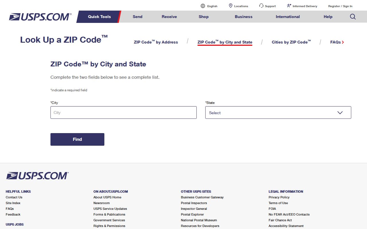
The result is a postal answer, not a finding about municipal ownership, residence, or a statistical neighborhood. Save the returned city name and query mode with the address record.
Finding Denver Residents by ZIP Code
A ZIP code directory can narrow a research question, but Denver's principal public systems accept different keys. Spatialest starts with Address or Parcel Number and has no direct ZIP search control. The owner mailing ZIP, called ZIPBASE in the parcel detail and export, appears after a parcel is found. Colorado's voter lookup is person-first and requires a name, ZIP, and birthday. Accela Licenses is the researched local portal with an actual ZIP field.
- Verify the postal code and recognized city in USPS, then keep the result date and mode.
- Use Spatialest with a known address or PARID. Record situs, owner mailing address, ZIPBASE, and legal description as separate fields.
- For an identified person, use the Colorado voter lookup with first name, last name, ZIP, and birthday. A confidential record or recent move can produce no match.
- Use Accela's business-license search when the research question concerns a license or permit tied to a ZIP, address, unit, or parcel. Do not turn a license record into proof of residence.
- Once a ZIP narrows the area to streets, shift to the Denver street directory for address-keyed parcel and deed work.
The result is a set of leads, not a bulk resident roster. A ZIP may describe the owner's mailing destination, a voter record's search key, or a licensed activity. Label the source before comparing rows.
Denver ZIP Fields in Accela and Spatialest
Spatialest is parcel-first. Its visible controls are Address and Parcel Number, with autocomplete, map, full, and shape search. Results can be sorted by Schedule Number, Address, or Owner Name, viewed up to 300 entries, and exported to Excel up to 500 rows. The absence of an owner-name or direct ZIP input matters: a ZIP-filtered export is not the same as a ZIP search.
| System or field | Available input | Useful output | Limit |
|---|---|---|---|
| Spatialest | Address or Parcel Number | Situs, owner, ZIPBASE, PARID, legal description | No direct ZIP or owner-name control observed |
| Spatialest map | Parcel selection and layers | Parcel geometry, neighborhoods, zoning, FEMA, streets | Layer boundaries are not postal boundaries |
| Accela Licenses | Street, unit, parcel, city, state, Zip | License or permit record tied to the search fields | Date searches use record creation date |
| Denver parcel open data | Dataset analysis | Parcel facts and owner ZIP metadata | Not a resident directory |
The Denver Assessor's Office guidance explains the public property fields that sit behind the parcel search.
Keep ZIPBASE beside, not instead of, the situs address. A mailing address can point to a PO box, a business, a family address, or another state.
Denver ZIP Processing Groups Differ
USPS processing groups explain how codes move through a destination post office. For example, the 80202 group includes 80201-80202, 80243, 80248, 80257, 80259, 80265, 80290, 80293-80294, and 80299. The 80203 group includes 80203, 80218, 80264, and 80273. Other documented examples include 80205 with 80207, 80206 with 80246, 80210 with 80208-80210 and 80250, and 80231 with 80237 and 80247. These groupings are postal operations, not a claim that the codes share a city line or neighborhood.
The monthly PostalPro City State Product is useful when a complete city, county, and post-office name list is needed. ZIPMove context also matters because postal realignment can change delivery geography without changing a city boundary. Treat a processing group as a routing clue, then check the parcel or official city layer for geographic conclusions.
The USPS City State Product reference is the source to revisit when a postal label or processing group changes.
A current ZIP code directory should preserve the postal source and date because the delivery product is maintained separately from Denver planning layers.
Denver ZIP, County, and Postal Geography
Denver's consolidated government makes labels easy to blur. “Denver” can mean the city and county, a USPS recognized city name, or a metro service label. The county checklist can include an adjacent service area, while a ZIP can cross a municipal line. Denver also has 78 statistical neighborhoods, but a statistical neighborhood is not a ZIP, RNO, tax district, zoning area, or parcel.
QuickFacts supplies city context such as population, land area, and density. Those figures describe Denver city, not the count of delivery addresses in one ZIP. Use the city source for scale, USPS for postal routing, and parcel GIS for the exact lot and boundary question.
The Census QuickFacts Denver reference helps keep city statistics separate from postal counts.
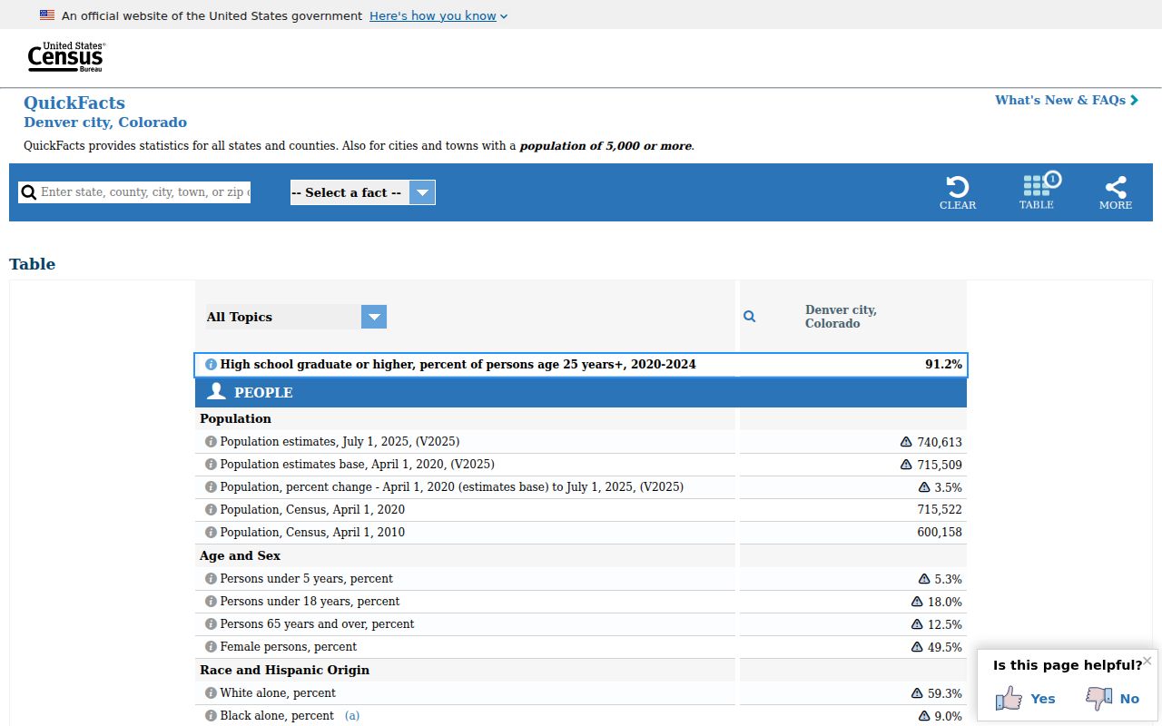
The city statistic supplies context for Denver, while USPS and parcel GIS answer the narrower ZIP and address questions.
Boundary check. A USPS result that says Denver does not prove that the parcel is inside Denver's municipal boundary. Verify the exact address in USPS and the parcel layer before assigning a civic geography.
Denver ZIP Addresses Start Locally
Postal routing begins after a municipal address exists. Denver DOTI's address policy says the City Engineer or designated authority assigns addresses under DRMC 49-56 and a 2010 policy. Address requests should precede a permit application, use e-permits, and go through Addressing@denvergov.org or 720-865-3002. The researched policy lists a $60 charge per address or unit. That fee concerns municipal address assignment, not a USPS ZIP search.
Street names and numbers can change. A rename affects legal documents, maps, and emergency-address references. Preserve the old and new street strings, lot and block, plat, parcel number, and postal address in the research note. The legal description can bridge a change when a ZIP or directory search uses an older label.
The Denver Property routing page is a useful handoff from postal verification to parcel, tax, and assessor information.
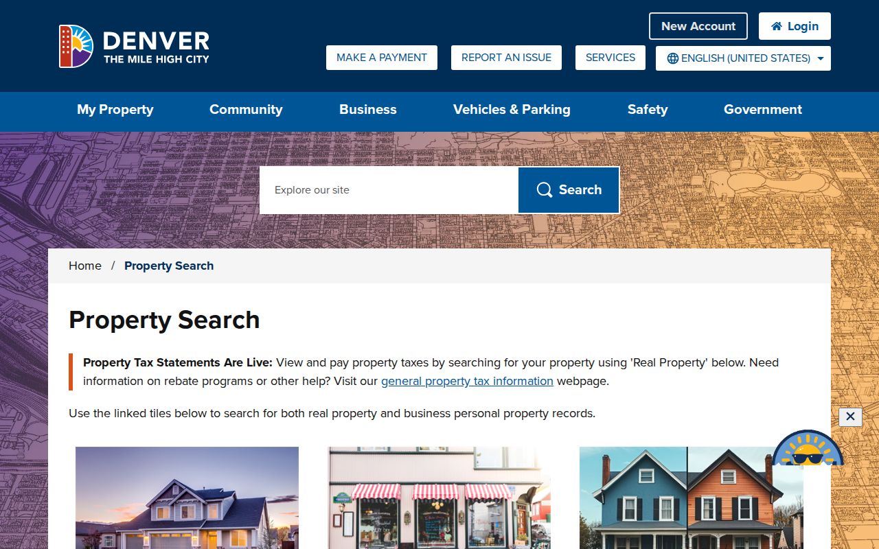
That handoff keeps a ZIP code directory focused on delivery geography while the parcel record answers location and legal-description questions.
Denver ZIP Code Terms for Clean Notes
These terms prevent a postal result from being overstated. Record the query type beside the result, especially when a code is unique, PO-box oriented, or associated with more than one city name.
- ZIP code
- A five-digit USPS delivery area used to route mail. It is not a parcel polygon or a guarantee of city limits.
- ZIP+4
- The five-digit code plus four digits that narrows delivery to a smaller route, block, building, or delivery segment.
- PO-box ZIP
- A code used for post-office box service. It may not describe the location of a residence or parcel.
- Unique ZIP
- A code assigned to a single organization, facility, or special service rather than a broad residential area.
- Carrier route
- A delivery sequence used by USPS within a ZIP. It is a routing concept, not a public list of residents.
When a search needs a street, parcel, deed, or historical occupant, move from the postal key to the address record. The ZIP code directory supplies the first geographic filter, not the last word.