
Finding Denver Residents by Street
A Denver street directory search is an evidence chain, not a single browse screen. Start with a known address and keep the parcel, mailing address, voter result, deed, and historical occupant fields separate. The current owner may be an estate, trust, company, or absentee owner. A directory line may show a household member or business contact. Those distinctions matter when the question is who is connected to an address rather than who is legally tied to land.
The most useful order moves from broad location to narrow identity. It also keeps the voter lookup in its proper role. Colorado does not offer a public street-wide voter browse; the individual form is a confirmation step after a name, ZIP, and birthday are known.
- Enter the street address in the Denver Assessor's Spatialest search. Save the schedule number or PARID, situs address, owner label, legal description, and tax year.
- Use the parcel result and map to inspect adjacent parcels and the layers that matter to the address, including zoning, floodplains, neighborhoods, and street names.
- Use the Colorado voter lookup only for person confirmation. It requires first name, last name, ZIP, and birthday, and a protected record may not appear.
- Carry the owner or party name and legal terms into Denver PublicSearch. Search the recorded deed trail by party, reception number, date, book and page, or document text.
- Finish with Denver Public Library householder and criss-cross holdings for past occupants. An address-first directory can supply a historical household clue that a current parcel record cannot.
Note: A parcel owner, a mailing recipient, and a directory occupant are related clues, not interchangeable proof of residence.
Denver Street Directory Search Fields
The Denver assessor interface is parcel-first. Its two text and autocomplete inputs are Address and Parcel Number. There is no owner-name or direct ZIP search field in the inspected configuration. Map, full, and shape controls broaden the search, while result sorting by schedule number, address, or owner name changes order rather than the query itself.
| Field or control | Type | What it does | Limit or note |
|---|---|---|---|
| Address | Text/autocomplete | Finds a known street address and suggests matches | Not visibly marked required |
| Parcel Number | Text/autocomplete | Finds a schedule or PARID record | Not visibly marked required |
| Map, full, shape | Map controls | Selects an area or parcel visually | Useful for a street segment |
| Sort | Schedule #, Address, Owner Name | Changes result order | Owner Name is not a search box |
| Result view | List | Shows up to 300 results | Excel export is capped at 500 |
| Layers | Toggle menu | Adds parcel, street, zoning, neighborhood, flood, and enterprise context | Layer labels define the geography |
A parcel detail can expose Full Address, Situs Address, Owner Names, OwnerFullAddress, ZIPBASE, Schedule Number/PARID, legal description, zoning, tax district, land and building square feet, neighborhood, value by tax year, tax notices, sale date, and sale price. Keep the situs field apart from OwnerFullAddress. A mailing ZIP can sit outside the parcel's postal or municipal area.
Denver GIS Layers Along Streets
A street search gains depth when the target parcel is read beside its neighbors. Turn on the Parcel Layer and Street Names, select the address, and save the PARID before clicking adjacent parcels. OpenStreetMap and Nearmap Aerial basemaps help with orientation. County Boundary, FEMA Floodplains, Enterprise Zones, Neighborhoods, and Zoning add separate civic or land-use descriptions. None of those layers is a resident roster.
The Denver parcel open-data layer shows why a structured export is useful for a lawful comparison of address, value, neighborhood, tax district, style, bedrooms, baths, year built, and effective year built.
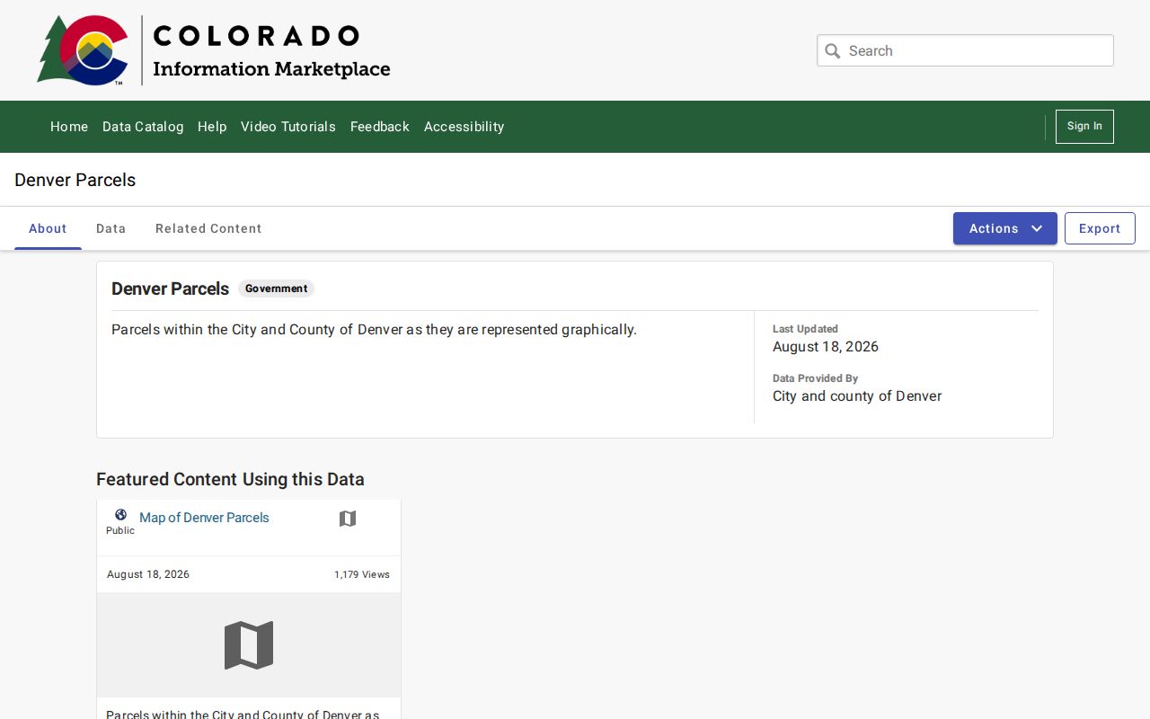
The open-data layer supports parcel analysis, while the live assessor detail supplies the owner and mailing fields. A map edge, alley, right-of-way, condominium line, or data error can make visual adjacency misleading, so confirm the legal description before joining two records.
Note: Denver's 78 statistical neighborhoods and more than 200 registered organizations are different layers from ZIPs, RNOs, tax districts, and parcels.
Denver Street Address Fields
Address words carry different meanings in Denver records. Situs identifies where the parcel sits. OwnerFullAddress and ZIPBASE point to the mailing destination used in the assessor result. A legal description names the lot, block, addition, subdivision, or metes-and-bounds tract. A plat is the map that relates those legal pieces to streets and lots. A criss-cross directory reverses the usual name search by starting with a street address and listing an occupant or business when the edition supplies one.
- Parcel
- A mapped land unit identified by a schedule number or PARID and tied to a legal description.
- Situs address
- The physical address assigned to the parcel, not the place where tax notices are mailed.
- Plat
- A recorded subdivision or lot map that can bridge a street string to block and lot terms.
- Criss-cross directory
- An address-first historical source for occupants, households, or businesses in a printed year.
Writing these fields into separate notes prevents a common error. An owner mailing address can be a post office box, business address, family address, or address in another state. It is a useful clue, but it does not prove that the owner lives at the situs. The same care applies to a historical directory name.
Denver Records Along a Street
The address-record trail joins several custodians. The parcel and GIS layers establish current land geometry. PublicSearch supplies the recorded-party index. Permits add construction or project context. The voter form is person-first, and the historical directory is year-first or address-first. The table keeps those roles distinct.
| Record set | Keeper | What it shows | Access |
|---|---|---|---|
| Assessor parcel | Denver Assessor / Spatialest | Owner, mailing and situs fields, legal description, value, tax district, zoning | Current online parcel search |
| GIS parcel map | Denver parcel data | Adjacent parcels, aerial view, flood, enterprise, neighborhood, zoning, street layers | Online map and open data |
| Deeds and plats | Clerk and Recorder / PublicSearch | Parties, reception, date, document type, book/page, legal continuity, image when available | Index online; paper or image gaps |
| Voter lookup | Colorado Elections | Individual registration match and status workflow | Name, ZIP, birthday; protected records may be absent |
| Permits and logs | Denver Community Planning and Development (CPD), DOTI, DPL | Construction, alteration, demolition, applicant, project, and date clues | Online, counter, Colorado Open Records Act (CORA), or historic holdings |
| Householder/criss-cross | Denver Public Library Special Collections and Archives (SCA) | Past address occupants or businesses by edition year | 1924-2018 holdings; 1924-1937 digitized |
Open Denver PublicSearch for the recorded-document index route. Its guest search begins with a department, search term, recorded date range, and a choice between index-only and index plus full-text optical character recognition (OCR). That result points toward the legal instrument, not a complete list of residents.
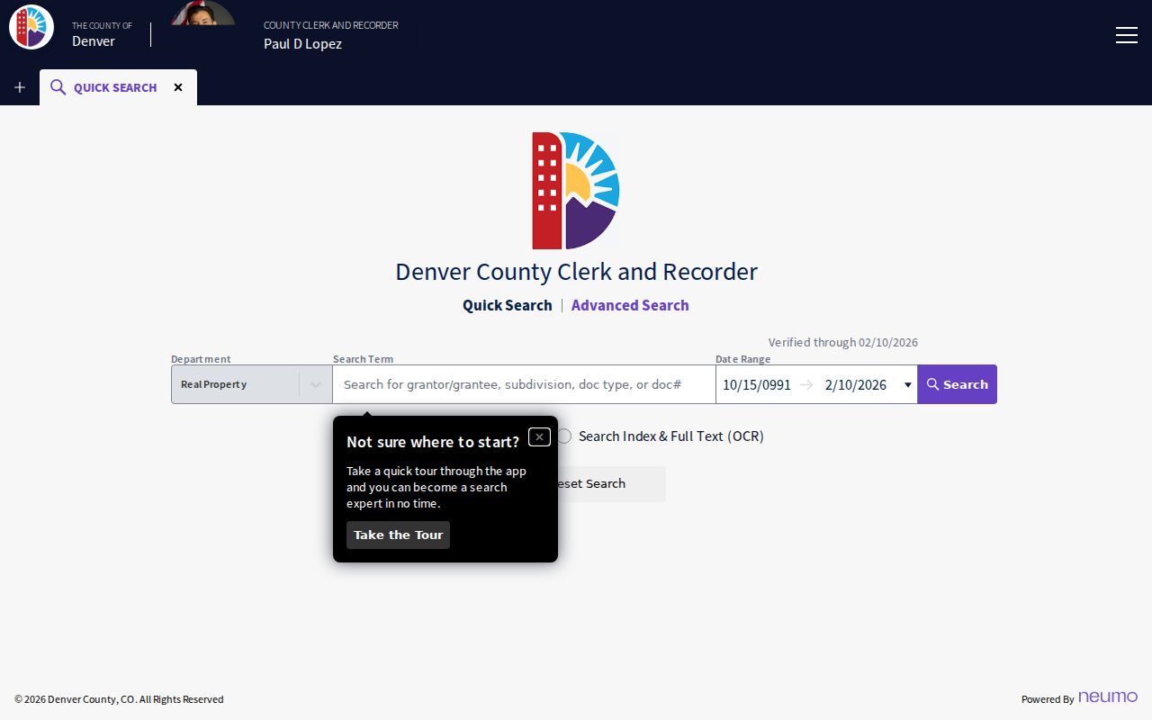
The image and index can help locate a reception number, but a missing scan does not erase the underlying record. Keep the parcel key, legal description, and recorded date in the research note before moving to a request.
Denver Deed Chains by Address
A deed chain follows instruments, not people. In PublicSearch, the quick search accepts a department, search term, recorded-date range, and index-only or OCR scope. Two or more words in index-only mode are treated individually, while OCR can search a phrase in scanned text. Advanced search adds Party Names, Grantor, Grantee, Reception Number, recorded dates, document type, Book and Page, and Full Document Text.
Start with the current parcel owner as grantee and use a broad date range. Record the latest reception, grantor, grantee, recorded date, document type, legal description, and image or certified-copy control. Then search the prior grantor as grantee. If the legal description changes, bring in the plat and assessor ledger before calling it the same land. A reception number is the stable handoff when an image is absent.
Denver's digital history has a useful tension. The 2021 records-management audit described CountyFusion records from 1859 to the present and more than 11 million documents, with newly imaged records uploaded overnight for next-day availability. It also described paper records that still need a request, plus a permit and monthly fee for bulk digital data. Online indexing is one stage in the chain, not the end of it.
Note: A deed transfer may name an estate, trust, lender, or company, so title evidence needs a separate occupant source.
Denver Permits by Address
Permit records add a built-environment timeline to a street directory search. Denver's public Accela Licenses module can search by record number, record type, record name, creation-date range, street number, direction, street name, street type, unit, parcel, city, state, and ZIP. The date is a record creation or reference date, not a promise that work was completed on that day.
Open Denver's business-license search when a street address has a license or public-health record to compare with the parcel. The long type list includes business, food, liquor, lodging, child care, body art, security, massage, peddler, tow, valet, and other local records.
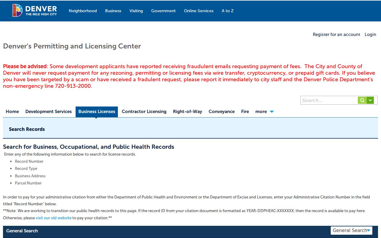
A license name is a record clue, not proof that a named person lives at the address. The same caution applies to a project applicant or contractor.
Denver Development Services search adds record number, record type, application or project name, and start and end dates. The portal supports construction, demolition, electrical, mechanical, plumbing, roofing, sewer, subdivision, zoning, landmark, fire, complaints, and certificate records. Historical coverage is split: logs for 1889-1892 and 1900-1914, permits for 1915-1955, no official permits located for 1955-1959, CPD records through CORA or appointment for 1960-1969, counter records for 1970-present, and online permit/licensing access from 2000-present.
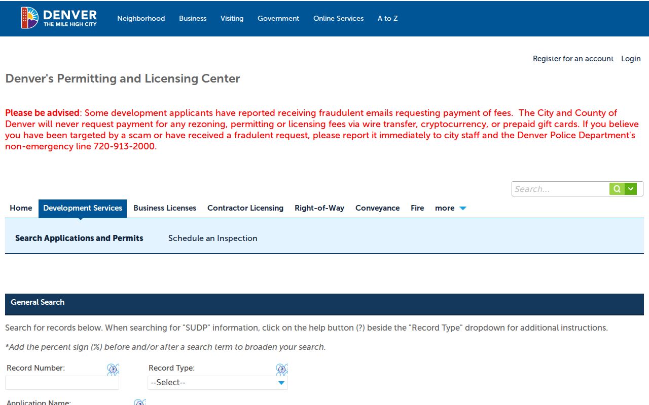
The gap from 1955 to 1959 belongs in any construction timeline. It is a records-access limit, not evidence that a building had no work during those years.
Denver Street Numbers and Legal Descriptions
Denver's City Engineer or designated authority assigns addresses under DRMC §49-56 and a 2010 policy. The DOTI policy lists a $60 charge per address or unit and asks that an address request precede a permit application. That municipal assignment is separate from USPS delivery geography. The address record helps explain why a permit or map uses one number while an older directory uses another.
Denver DOTI's right-of-way guidance is the route for address and permit context. A street rename changes legal documents, maps, and 911 references. Since 2002, the city has generally avoided renaming except for emergency, health, or safety reasons.
The legal description is the bridge across that change. Preserve the addition or subdivision, block, lot, plat, parcel, map landmark, and every old street string. A current ZIP or recognized USPS city name cannot replace that legal continuity.
DOTI's address-types policy shows why an address record can have more than one label. Compare the assigned location with the parcel situs and the delivery address before joining records from different eras.
For a difficult number change, search the old and new street names, then test the legal description against the assessor map and deed chain.
Denver Street Directory Occupant History
The Denver Public Library's householder, street, and criss-cross holdings run from 1924 to 2018, with 1924-1937 digitized. These volumes reverse the alphabetical city directory. Start with a street number, read the occupant or business notation for that edition, and record the exact page and spelling. A missing line can mean a skipped edition, a changed number, a change in the printed coverage, or a scan problem. It does not establish that nobody lived at the address.
The historical shelf belongs with the Denver city directory collections, while current parcel and deed work stays address-keyed. Pair a criss-cross line with a same-year city directory, deed, assessor card, permit, newspaper, or obituary. That comparison keeps an occupant clue separate from an owner-of-record claim and helps recover an older street number.
Note: DPL's criss-cross run is broad, but exact edition availability varies by year and by whether a page has been digitized.
Limits of a Denver Street Directory
A Denver street directory cannot show every person connected with a parcel. The public voter form is an individual name, ZIP, and birthday check, not a street browse. Protected voters, including people using a confidential address program, may be absent or represented by a substitute address. Court, vital, DMV, utility, and other personal records also have their own access rules.
Do not turn a tax mailing address into an occupancy claim. Do not copy an exact birthday, protected address, phone number, or other identifier when a source does not require it. If a result is wrong, take the citation to the custodian: the Assessor for parcel data, Elections for registration status, the Clerk and Recorder for a deed index, or DPL for a directory scan.
Lawful use. Denver street and address records are for personal, lawful research. Using a record to stalk, harass, intimidate, or harm another person is not a lawful use.
A careful street directory is therefore a comparison tool. It can connect an address to a parcel, legal instrument, permit, map layer, or historical household clue while leaving private and protected details with the custodian.